

Maps of the Month: June 2026
The most interesting maps and articles I came across in June 2026

In Europe, we’ve kicked off this summer with pretty high temperatures. In Spain, we’ve already had one heatwave, and the second one is just beginning. Right on schedule, so we don’t get out of the habit. I could well have bored you with maps about climate change, extreme weather and how it’s not as hot as it used to be, but I already covered that last month and I don’t want to go on and on about it.
June has been a month full of events and discoveries. Some very interesting things related to maps, which I’m compiling for you today, as I do every month, in the maps of the month. Here’s what you’ll find in this edition:
‘What’s Your Map?’, the Oculi Mundi podcast
Bill Rankin’s radical cartography
The double earthquake in Venezuela (25 June)
The earthquake in the Philippines (8 June)
Ebola in the heart of Africa
The biggest World Cup in history
Players representing countries where they weren’t born
A century of divergence between Greece and Turkey
Spain: Your local council in Parliament
The DC Universe
When a map can be a statement
Memory Map (2000)
What’s Your Map?, the Oculi Mundi podcast
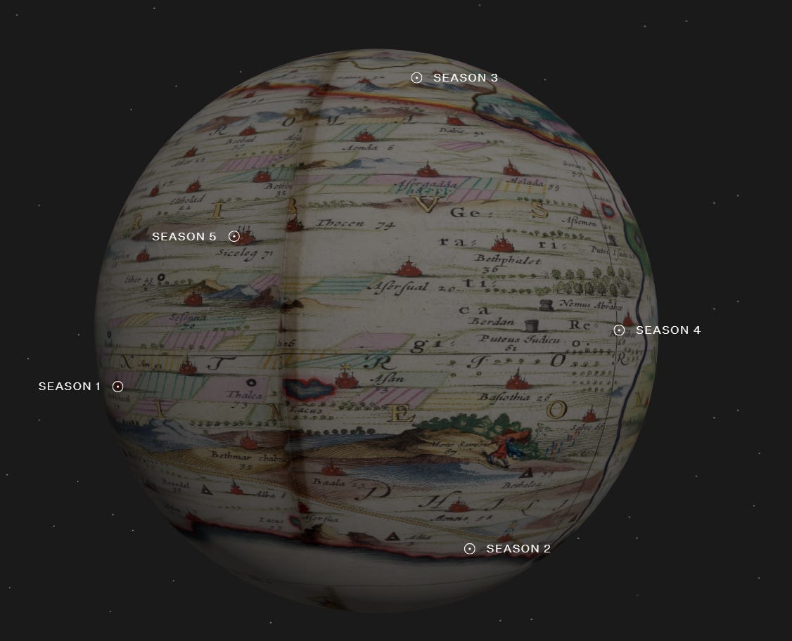
A few weeks ago, Molinos passed on a recommendation to me. Ana knows a great deal about podcasts, surely more than anyone else in Spain. Thanks to her, and to the recommendations in her newsletter1, I’ve discovered gems such as Twenty Thousand Hertz and The Anthropocene Reviewed. But this time, the recommendation was aimed specifically at me: a podcast about cartography. When I saw it was a project by Oculi Mundi2, I had no doubt it was going to be top-notch.
The premise of the podcast is simple: cartography historian Jerry Brotton3 invites an expert onto each episode and asks them about their favourite map. In the first episode of the first series, for example, William Dalrymple talks about the maps of Jain cosmography; two episodes later, Peter Barber discusses Gemma Frisius’s world map from 1544. I’ve listened to more than half the episodes, and the wealth of knowledge and the quality of the conversations never let you down.
It’s now in its fifth series, and the episodes can be listened to directly from the Oculi Mundi website.
Bill Rankin’s Radical Cartography
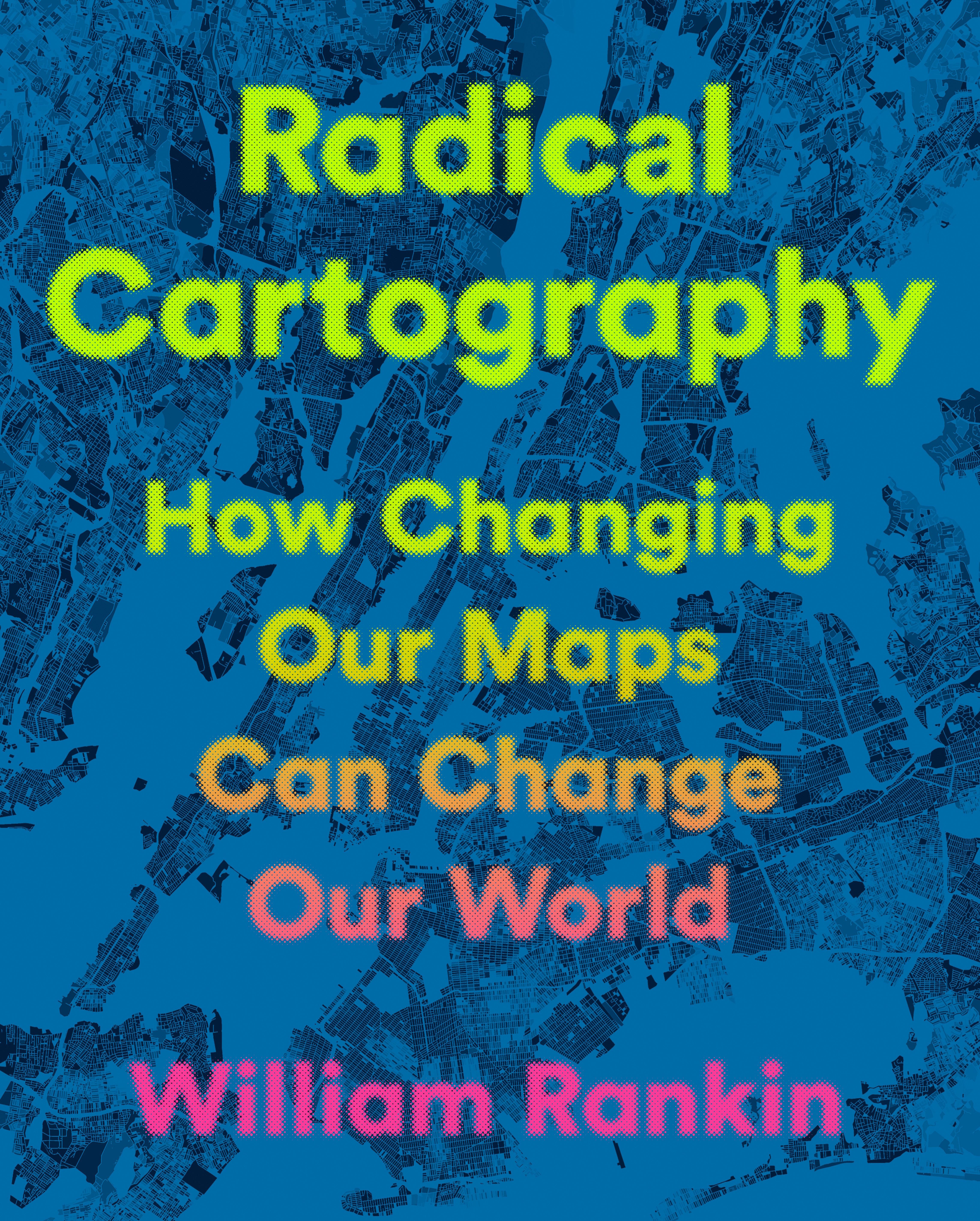
Thanks to Ana and her podcast recommendation, this past June I bought five more books on cartography that looked absolutely brilliant and which I didn’t have in my collection4. One of these was Radical Cartography by Bill Rankin, a well-known academic whose work precedes him.
In this book, Rankin presents the central thesis of his entire professional career: maps are not neutral representations of reality, but political objects that define what is seen and what is concealed. It contains over 150 full-colour maps organised around seven basic elements: boundaries, layers, people, projections, colour, scale, and time.
You know how fascinated I am by this subject, so I wasn’t surprised to find several cartographers and maps in there that I’ve already covered, such as the Dymaxion map or the Palestinian archipelago. But there are many more that I didn’t know about, and I’m discovering them page by page with the excitement of a small child on Christmas Day.
It might well turn out to be the best book on cartography I’ve ever read. And that, even if it is subjective, means something.
The double earthquake in Venezuela (25 June)

This year began with Venezuela in the news, and it seems the problems are not about to leave the country in peace. On 25 June, two earthquakes measuring 7.2 and 7.5 shook the north of the country within a few hours. As shown by the map from El Orden Mundial which you can see above, the country lies between the Caribbean Plate and the South American Plate, a region that is not as seismically active as other parts of South and Central America, but which has once again brought tragedy to Venezuela almost fifty years after the 1967 Caracas earthquake.
Several factors have combined to make this earthquake extraordinarily devastating: buildings completely unprepared for earthquakes, a government lacking the resources to respond to emergencies, and two tremors in densely populated regions. At the time of writing, there are more than 2,000 recorded fatalities, but with tens of thousands missing and the country’s limited resources for clearing the ruins, the final toll is likely to be much higher.
Here is an article by Judith A Hubbard and Kyle Bradley where you can find out more about the science behind this earthquake.
The Philippines earthquake (8 June)
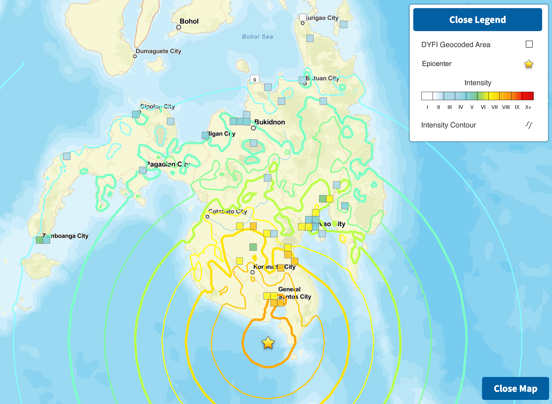
Twelve days before the earthquakes in Venezuela, the Philippines also recorded a magnitude 7.8 earthquake south of the island of Mindanao. A tsunami warning was issued for nine Philippine provinces and, fortunately, was lifted hours later as the waves did not reach the predicted intensity. To date, 88 people have been reported dead and 30 missing, a figure far lower than that of the earthquakes in Venezuela. Why is this?
Although the earthquake in the Philippines was of greater magnitude, it was a single event, whereas Venezuela suffered two earthquakes of similar magnitude within a few hours of each other. The Philippines is also fortunate to be located within the Pacific Ring of Fire5, meaning its infrastructure and buildings are much better prepared than those in Venezuela. Furthermore, and perhaps most importantly, the Philippine earthquake occurred just a few kilometres off the coast and at a greater depth; consequently, once the risk of a tsunami had been ruled out, the impact on the region’s population was less severe.
Ebola in the heart of Africa
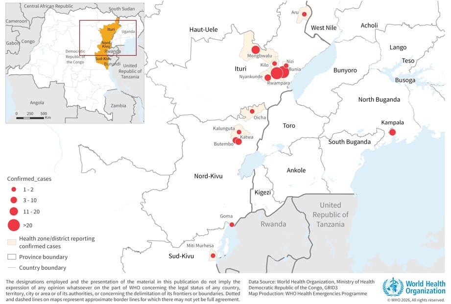
Thanks to this article by Ritchie Cunningham, I have learnt that there is once again an Ebola outbreak in Africa. It was first recorded in early May in the Democratic Republic of the Congo and has spread across the north-east of the country and into Uganda. The bad news is that it is the Bundibugyo variant, for which there is no vaccine.
As is often the case in such situations because this is an outbreak in Africa that is more or less contained, it rarely makes the headlines in the West, but the problem is serious. Following cuts to USAID funding and the withdrawal of funds for epidemiological surveillance, these outbreaks are much more difficult to control. Unfortunately, many will only tackle the root of the problem when it directly affects them.
The biggest Football World Cup in history
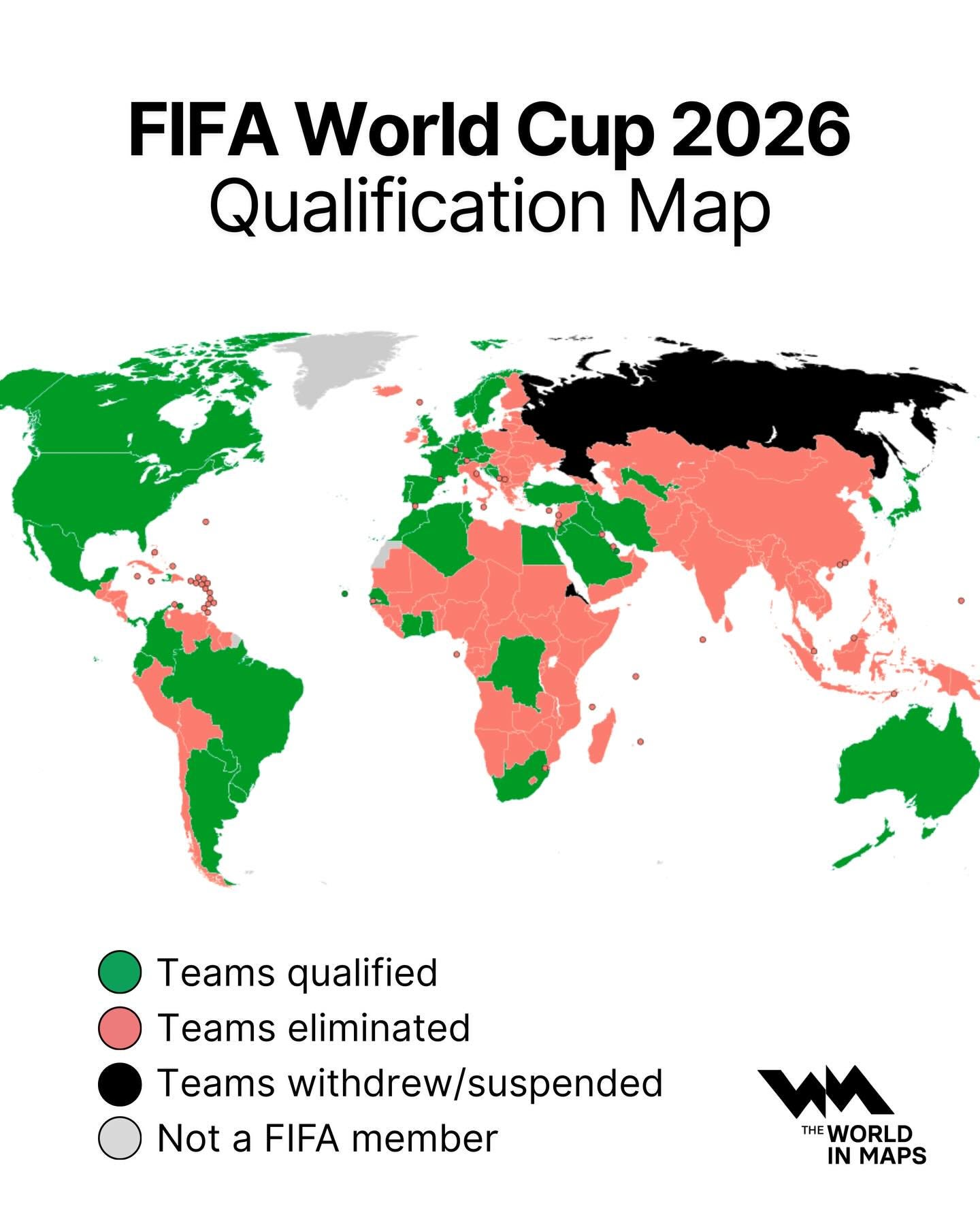
Moving on to a slightly less dramatic topic6, on 11 June the first match of the Football World Cup kicked off at the Estadio Azteca in Mexico City with a clash between Mexico and South Africa. As a result, the Estadio Azteca has become the only stadium in the world to have hosted matches in three different editions of the World Cup: 1970, 1986 and 2026.
But perhaps the most interesting aspect of this World Cup is the number of participating teams. Thanks to changes made by FIFA in an attempt to attract a larger audience, the number of teams has increased from 32 to 48, making this the World Cup with the most participating countries, as you can see on the map above. FIFA had hoped that a demographic giant such as China or India would qualify from Asia, but the result has been that countries such as Curaçao and Cape Verde have been able to make their debut for the first time.
Players representing countries where they were not born

This map, published by Geoallday, also reveals a very insightful detail about World Cups and the composition of the various national teams. The number next to each country on the map represents how many of the team’s 26 players were born outside the country they represent. Intuitively, many of us would assume that the figure would be 0 or very few, but the reality turns out to be surprising. In countries such as Morocco, Algeria, Bosnia and Herzegovina, the Democratic Republic of the Congo, Qatar, Haiti and Tunisia, more than half of the players were born abroad.
There are many reasons for this: labour migration flows to Europe, sports recruitment policies such as those in Morocco, or the post-colonial diaspora from many African countries. The result is that a football team’s nationality is a constructed category, and FIFA’s eligibility rules are arbitrary enough that choosing between two countries is more a matter of opportunity and visibility than of identity.
A century of divergence between Greece and Turkey

This June, an infographic/map has been circulating repeatedly on many social media platforms. It is a comparative map of the populations of Greece and Turkey from 1927 to the present day. I have tried to trace its origin, and it appears to have evolved from this Facebook page, although I have also come across versions from several years ago that may have served as inspiration. Of all of them, I have opted for this one from Civixplorer.
The starting point for understanding this map is 1923, when the Treaty of Lausanne was signed, leading to one of the largest forced population exchanges in history: 1.5 million Greeks were expelled from Anatolia and 500,000 Muslims were expelled from Greece. Following this, Turkey’s population was still larger than Greece’s, though the figures were comparable.
Subsequently, the birth rate in Turkey remained very high for decades, enabling it to reach its current population of 86 million. In contrast, Greece, which started out with around 7 million, has barely reached 10 million inhabitants due to economic emigration in the 1950s and 1960s, a low birth rate and an ageing population. This map tells the story of the divergence of two countries which, despite their differences, shared a common history.
The DC Universe
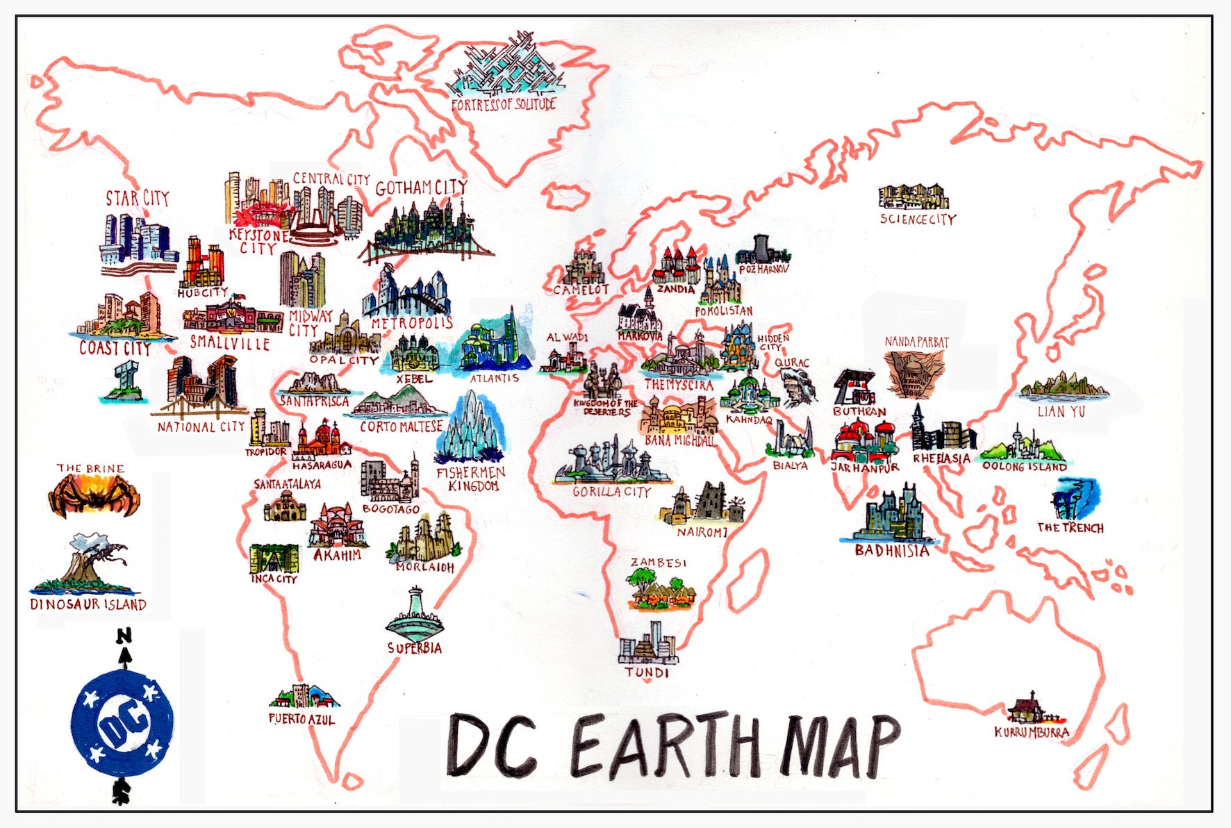
This isn’t the first time I’ve shared a map by Cristina with you, but she really does have some brilliant ideas. In this case, she explores the DC Universe in depth, looking at the various locations around the world that appear within it, ultimately creating this fascinating map.
According to DC, it appears that South America exists solely to harbour dictatorships and banana republics, whilst almost all the heroes are concentrated in Europe and, above all, in the United States. In a way, fictional maps never exist entirely within fiction, nor are they neutral about the real world: they reflect the worldview of those who created them.
When a map can be a statement
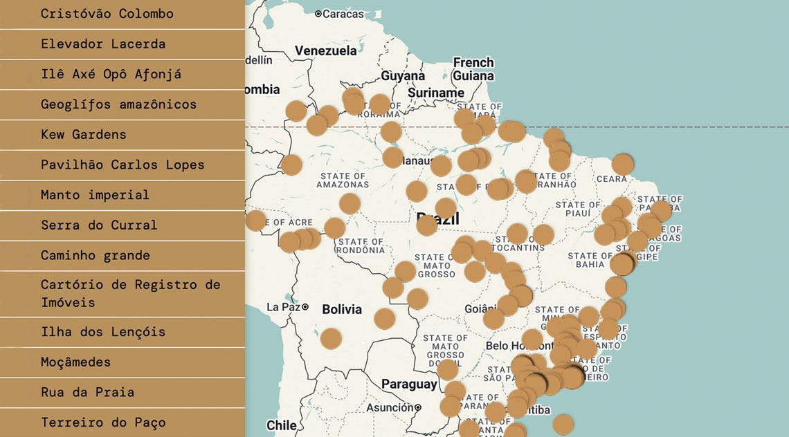
Through the Nosolosig newsletter, I came across this article published by the Brazilian magazine Pesquisa FAPESP. It discusses the Atlas do Chão, a digital mapping project launched by a Brazilian indigenous community that identifies places around the world linked to processes of colonisation and urbanisation7.
As many geographers, historians, and cartographers have said on numerous occasions, mapping a territory is, in a sense, to assert its existence. This map is the concrete way in which a Brazilian indigenous community is attempting to establish its place in the world.
Memory Map (2000)
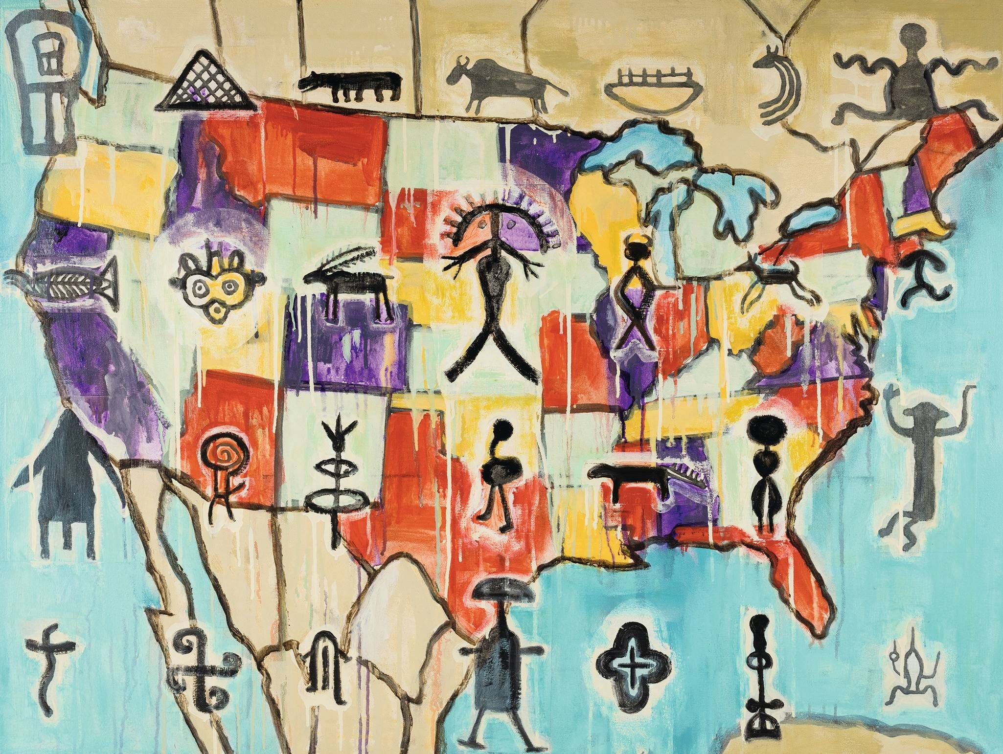
In the same vein as the previous project, we find the Memory Map by Jaune Quick-to-See Smith, one of the most important Native American artists of the 20th century. In this painting, Smith uses the outline of the 48 contiguous states of the United States as her canvas and transforms it into something else. Across the borders and colours of the political map, the artist has scattered dozens of symbols taken from the petroglyphs of the continent’s indigenous peoples. Schematic figures of animals, humans, spirals, crosses and other forms that have existed on these lands for millennia, long before there was any state to represent.
This is how Smith established a place in the world for herself and her community.
By popular demand, here’s a button for procrastinating, in case you have plenty of things to do, but you don’t feel like doing any of them. Each time you click on it, it will take you to a different map from the more than 1,200 in the catalogue.
If you like what you read, don’t hesitate to subscribe to receive an email with each new article that is published.
Written in Spanish, but through Substack now you can use the translation capability and give it a go.
Oculi Mundi (from the Latin for ‘the eyes of the world’) is the digital platform of The Sunderland Collection, a private collection of antique cartography founded over four decades ago by Neil Sunderland and currently managed by his daughter Helen Sunderland-Cohen. Based in Switzerland, the collection brings together over 130 cartographic items dating from the 13th century to the early 19th century. That may not seem like many maps, atlases and books, but these are items of a quality and significance matched by very few private collections. The platform was launched in October 2023, and is a visual delight.
The author of this great book, in case you need any credentials.
It isn’t particularly extensive, mind you. There must be more than a hundred and fewer than a hundred and fifty physical books. One day, I ought to count them and keep a catalogue, so I know what I’ve got.
All the coasts of the Pacific Ocean lie in tectonic plate subduction zones, making them one of the most seismically and volcanically active regions on the planet.
With a very significant bias towards Brazil, as one might expect.